GIS · Information Design · Civic
Street Paving Program
Every Street, Mapped and Scheduled
- Role
- Creative Director · Information Designer
- Year
- 2025
- Categories
- Civic · Innovation · Enterprise
- Tools
- Next.js · TypeScript · GIS · OpenStreetMap · Data Visualization
Live Interactive Preview
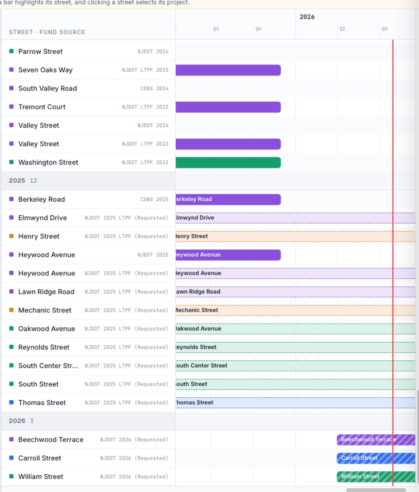
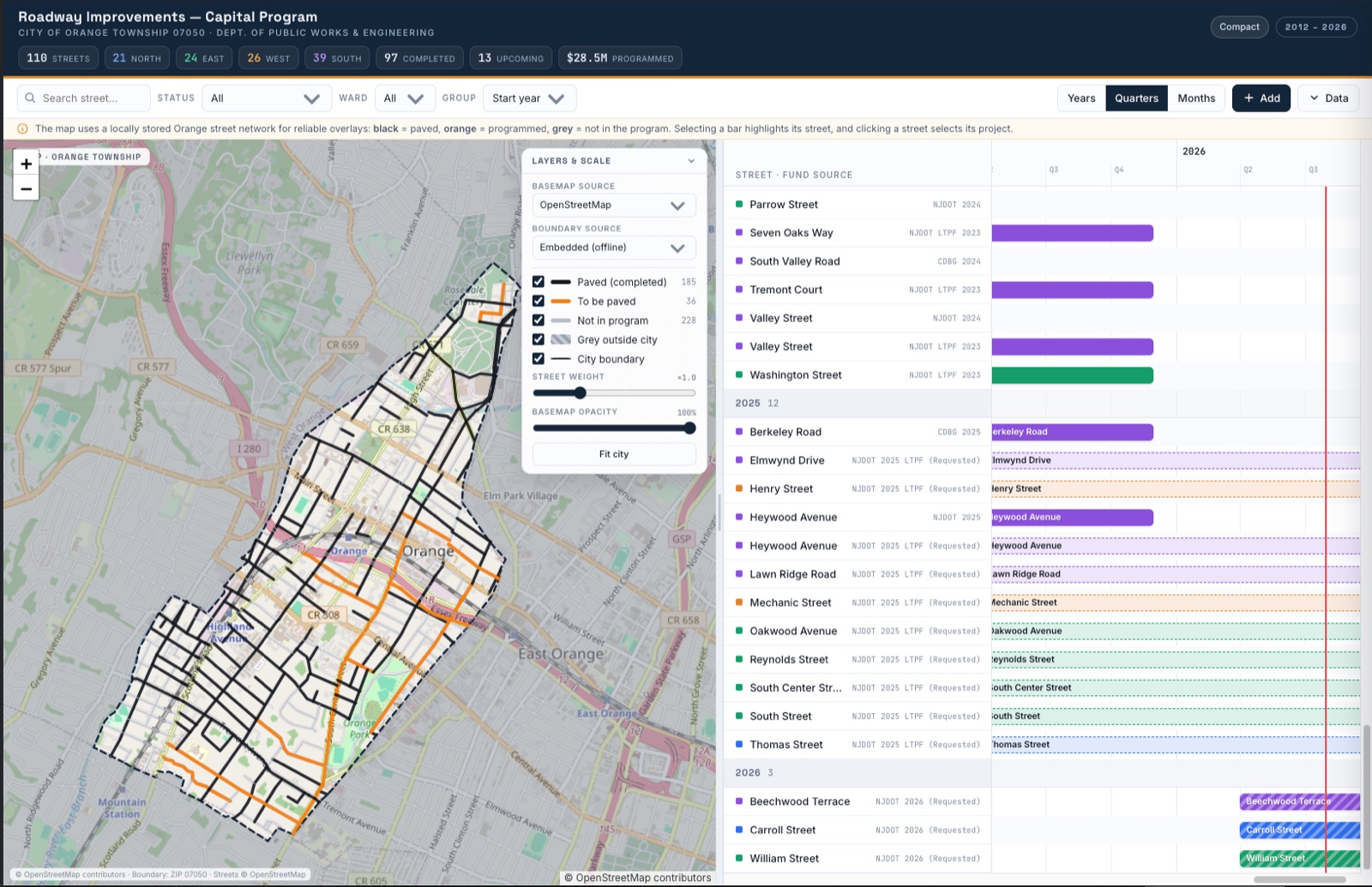
The live public dashboard — every street in Orange, mapped and scheduled.
 Open Live Dashboard
Overview
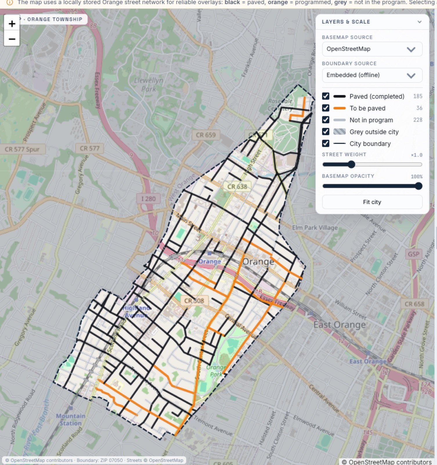
A roadway capital-program tool for the City of Orange — a live GIS map and schedule of every street, color-coded by status, with fund sources (NJDOT, CDBG, LTPF) and a multi-year timeline. $28.5M programmed across 110 streets.
The Challenge
Residents ask one question — when is my street getting paved? — and the answer lived in spreadsheets and grant paperwork. The work put every street, its status, and its schedule on one map.
Creative Direction
Direction built the program as a map first: black paved, orange programmed, grey not-in-program, over a locally-stored Orange street network — paired with a searchable, sortable schedule by ward, street, and fund source.